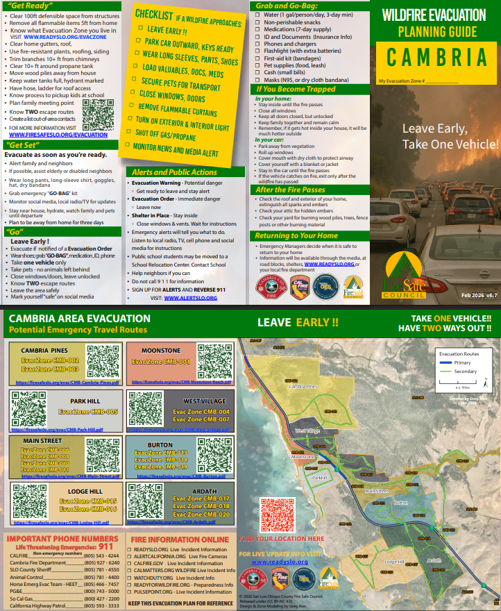
ReadySLO.org is San Luis Obispo County’s official emergency information site. It helps residents prepare for, respond to, and recover from emergencies. During disasters, it provides real-time evacuation orders, alerts, and resources from the County Office of Emergency Services. Use the “Know Your Evacuation Zone” tool to find your zone and get updates before, during, and after an emergency.
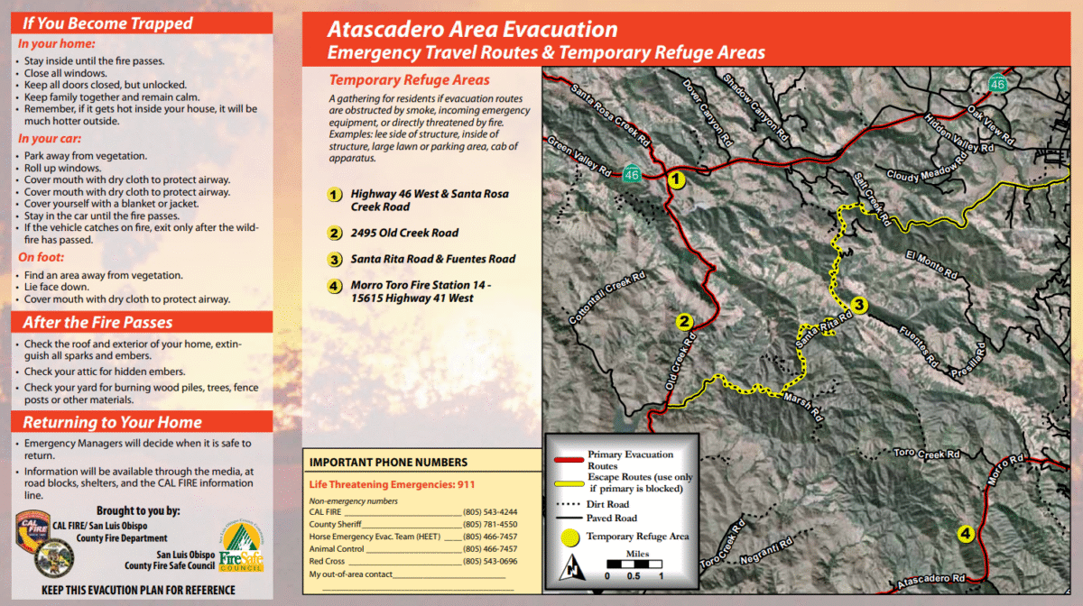
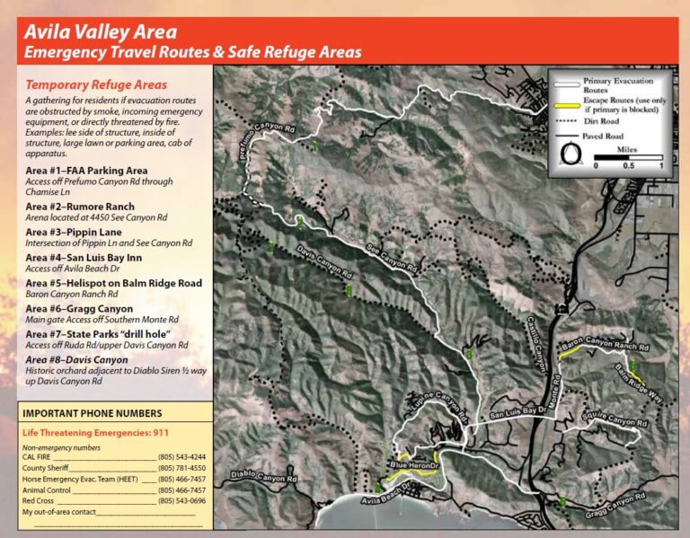
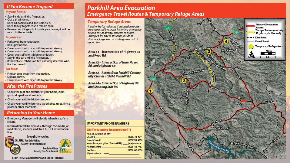
The FSC Evacuation Viewer is an interactive online map that lets you explore your community’s evacuation zones, view key evacuation routes and hazardous areas before a wildfire strikes. Use it to locate your home, check the safest exit paths, and get ready so you’ll know where to go if an evacuation order comes, giving you greater confidence and awareness to act quickly and safely during an emergency.
PulsePoint Respond is a free mobile app that provides real-time alerts for nearby emergencies, including wildfires, medical calls, and other public safety incidents. Linked directly to local fire and EMS dispatch centers, it helps residents stay informed, monitor active incidents, and receive evacuation-related notifications within their area — keeping the community safer and more aware.
AlertSLO.org and Reverse 911 is a geo-targeted alert system that lets public safety agencies send voice messages, texts, or emails to residents during hazards like wildfires, chemical spills, or evacuations. It ensures people in the affected area get timely, location-specific instructions and is a vital tool for evacuation readiness, helping communities respond more effectively and stay informed throughout an incident.