Downloads

Fisci & Friends Wildfire Children's Activity Coloring Book

fsc_dvd_cover-2

FIRE EDUCATION VIDEO

This video discusses the best ways to prepare your home for wildfire. We discuss clearance requirements and home preparation in San Luis Obispo County.   

2009_livingwfire

FIRE PREPAREDNESS HANDOUT

This informational flyer provides direction ont home preparedness, evacuation guides and safety checklists that will assist you in the event of a wildfire.

EVACUATION GUIDES

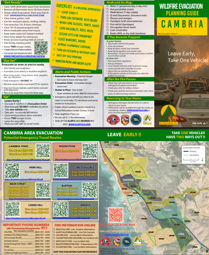
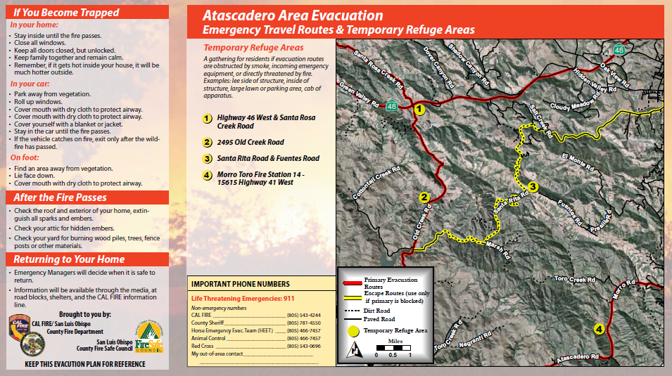
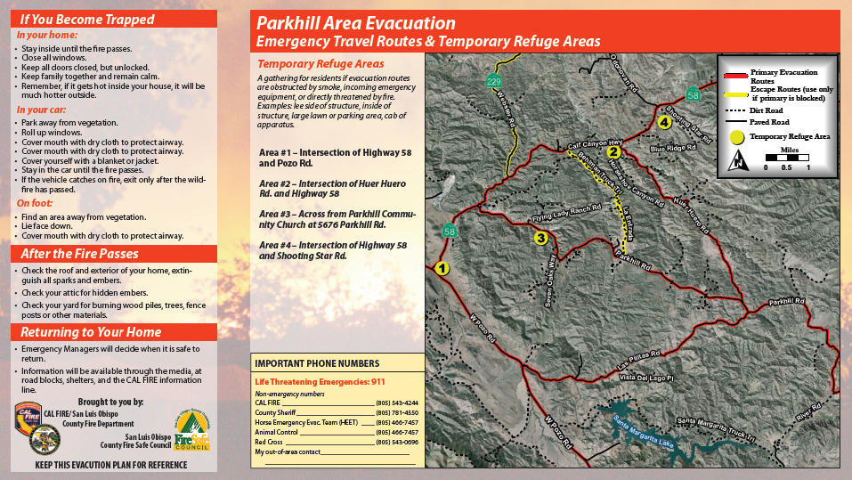
These evacuation plans were developed to give residents information on evacuating in the event of a wildfire. We are a proud sponsor of the CAL FIRE / San Luis Obispo County Fire Pre-Attack Plan products. These brochures identify primary evacuation routes, check lists and critical phone numbers. 

ATAEvacFlyer

ATASCADERO
EVACUATION PLAN

AVILA VALLEY
EVACUATION PLAN

CambriaEvac

CAMBRIA
EVACUATION FLYER

ParkhillEvacFlyer

PARKHILL
EVACUATION FLYER

LakeNaciEvac

LAKE NACIMENTO
EVACUATION MAP

PRE-ATTACK PLANS

FireSafe Council SLO is a proud sponsor of the CAL FIRE / SLU Pre-Attack Plan production. These maps provide an overview of fire prone areas throughout SLO County.   They are printed and made available to first responders before and when an incident occurs. These maps identify roads, homes, powerlines, water sources, and many other important locations within a fire prone area. 

Adelaida-PreAttack

ADELAIDA (West Paso Robles)

ArroyoGrande(East)-Preattack

ARROYO GRANDE (East)

Cambria-PreAttack

CAMBRIA

Cuesta(West)

CUESTA GRADE (WEST)

HWY_229

HIGHWAY 229 (CRESTON)

Huasna_PreAttack

HUASNA VALLEY (DRAFT)

Parkhill

PARKHILL

PasoRobles

PASO ROBLES

Ranchita

RANCHITA

SueyCreek

SUEY CREEK / UPPER LOS BERROS