
Coordinated Planning for a Safer Future
Introduction:
In the face of escalating wildfire threats, the San Luis Obispo County Fire Safe Council is spearheading a groundbreaking initiative known as the FIRESHED Project. This innovative endeavor aims to redefine the approach to wildfire and Wildland-Urban Interface (WUI) planning by establishing common geographic FIRESHED planning areas. Similar to watersheds, FIRESHEDs are defined by their shared geography and comprehensive wildfire characteristics. This article delves into the purpose, vision, and objectives of the FIRESHED Project, outlining how it promises to revolutionize hazard assessment, risk mitigation, ecological restoration, and emergency operations in San Luis Obispo County.
Purpose and Objectives:
The primary goal of the FIRESHED Project is to create unified FIRESHED management planning zones that serve as the cornerstone for WUI and wildfire planning. These planning areas will be instrumental in guiding stakeholder agencies and organizations in their endeavors related to hazard assessment, risk mitigation, ecological restoration, and emergency operations. Through the utilization of GIS-based tools, decision-makers will be empowered to formulate strategies, set goals, establish priorities, and implement best practices based on comprehensive datasets and FIRESHED characteristics.
Background and Rationale:
Currently, there are multiple independent efforts underway in San Luis Obispo County aimed at developing wildfire-related plans. While these initiatives have been successful in their own right, the potential for enhanced long-term value and efficiency lies in harmonizing these planning areas. By streamlining collaboration, data sharing, and analysis, the FIRESHED Project seeks to create a unified approach. Leveraging both public and non-public datasets, the project will refine and select appropriate data for incorporation.
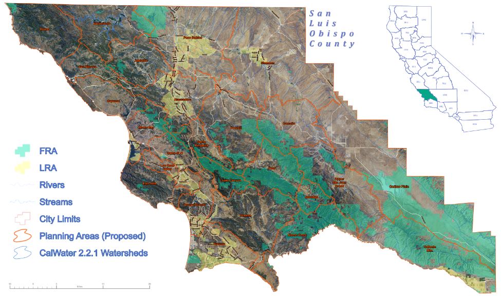
FIRESHED Project Vision:
Common Geographic FIRESHED Management Planning Zones: The project envisions clearly defined FIRESHED zones that serve as the focal points for planning efforts related to wildfire and WUI.
Comprehensive Written Report: The project aims to produce an in-depth report detailing the characteristics and significance of each FIRESHED.
Interactive GIS-Based Planning Tool: This tool will provide an interactive platform for stakeholders to explore, define, and allocate areas in San Luis Obispo County into distinct FIRESHEDS.
Public-Facing Component: A dedicated section on the SLO County Fire Safe Council website will offer accessible FIRESHED maps, along with information on fire and treatment history, and assets at risk.
Decision Support Tool: An easy-to-use GIS tool will enable decision-makers to analyze datasets and input ad hoc information, facilitating informed prioritization for mitigating wildfire impacts, guiding restoration efforts, and informing policy decisions.
Project Concept and Data Layers:
The heart of the FIRESHED Project lies in its GIS-based spatial representation of FIRESHEDs. Serving as the primary management unit, FIRESHEDs encapsulate common characteristics pertinent to natural and built assets, wildfire behavior, prescribed fire treatments, ecological restoration considerations, and more. A user-friendly interface will assimilate available GIS data layers, providing decision-makers with vital insights into management considerations and options.
Funding and Collaborators:
The FIRESHED Project is made possible through the generous support of:
California Climate Investments (@CAClimateInvest)
California State Coastal Conservancy (@ca_coastal)
The project is being executed in collaboration with contractors Rincon Consultants, Inc. and Resolute Associates LLC.
PlanningAreas_CalWater221_36x60_opt